
The Garmin GPSMAP® 8612xsv is a 12-inch high-performance network chartplotter designed for mariners demanding speed and advanced features. It offers an intuitive touchscreen interface and comprehensive network connectivity, facilitating integration with various marine systems.
Key Features:
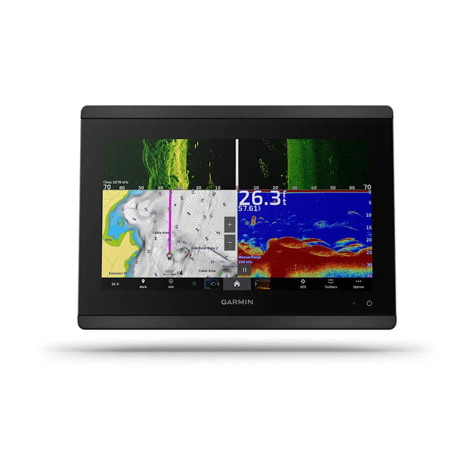
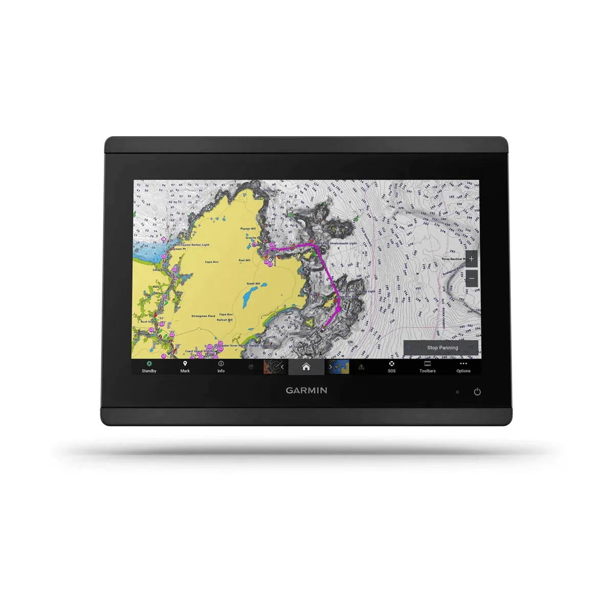
12-inch Full HD Touchscreen: IPS display providing wider viewing angles, superior clarity, and optimal sunlight readability, even with polarized sunglasses.
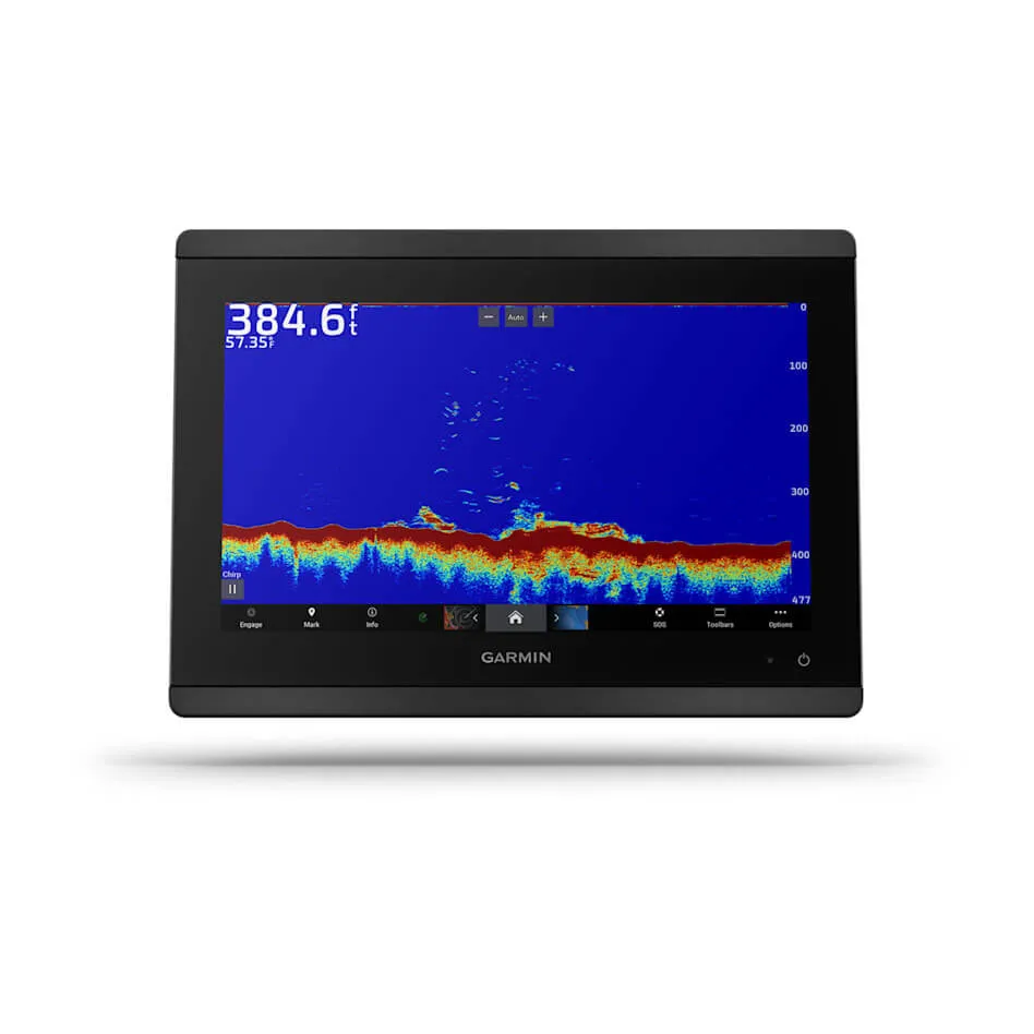
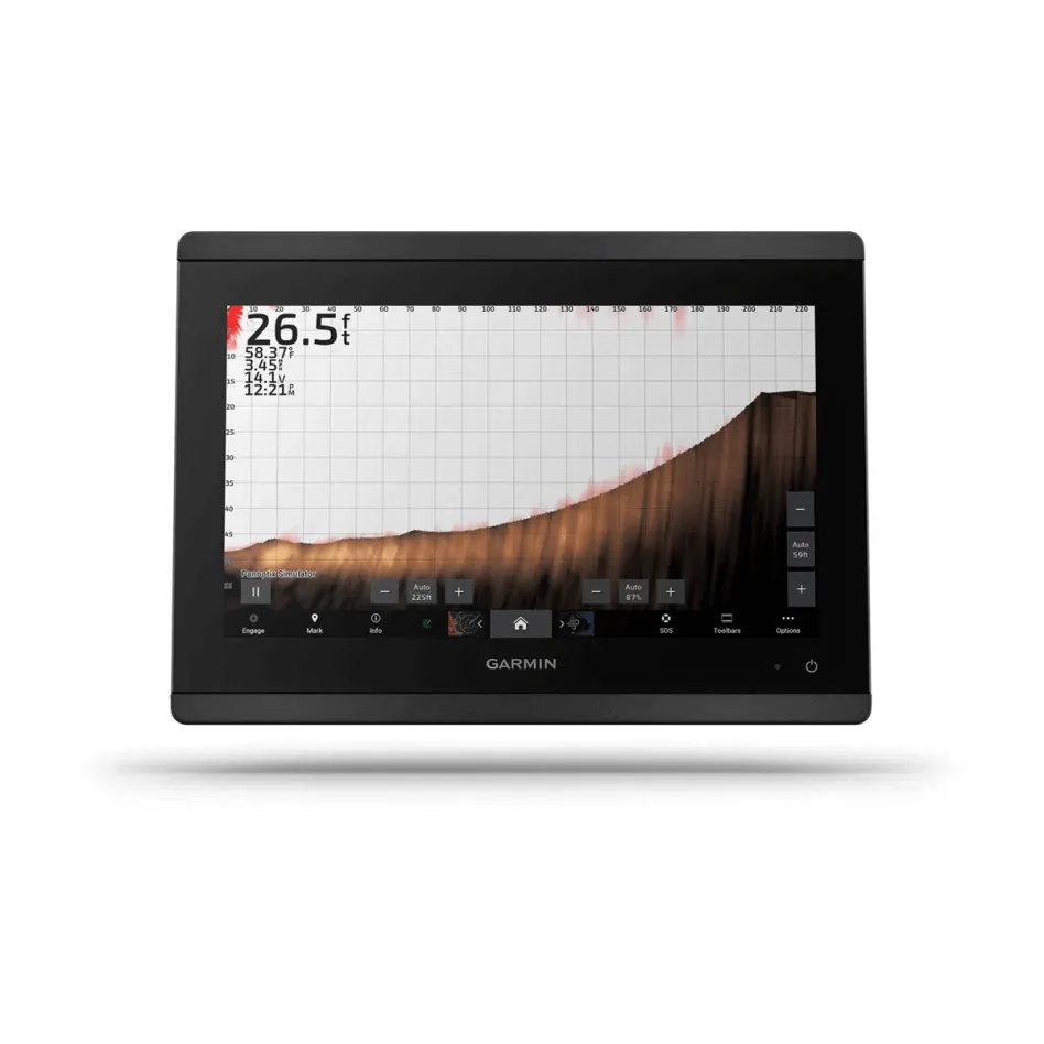
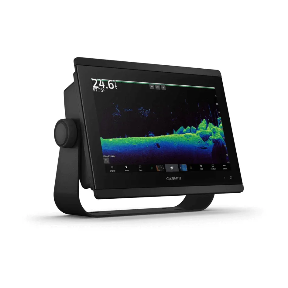
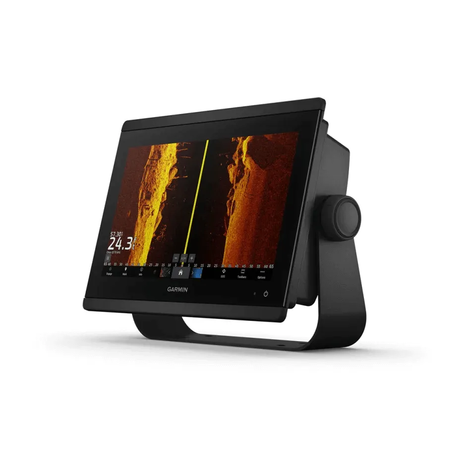
Built-in Sonar: Supports traditional CHIRP, ClearVü™, and SideVü™ sonars for detailed images beneath and around the boat. Compatible with Ultra High-Definition scanning sonar and the full range of live sonar products (transducers sold separately).
Preloaded Mapping: Includes Garmin Navionics ™ coastal and inland maps with Auto Guidance ™ technology for simplified route planning (for planning purposes only; does not replace safe navigation operations).
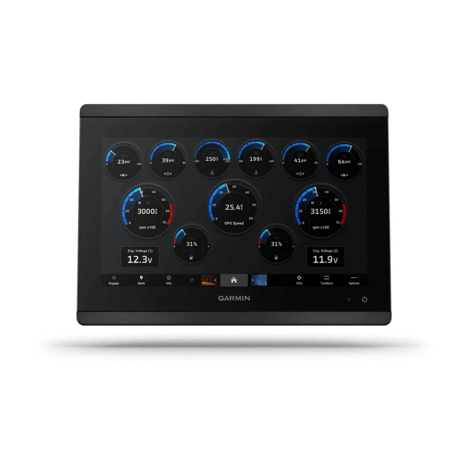
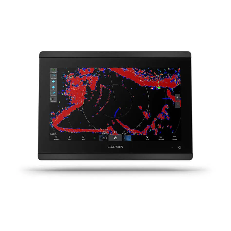
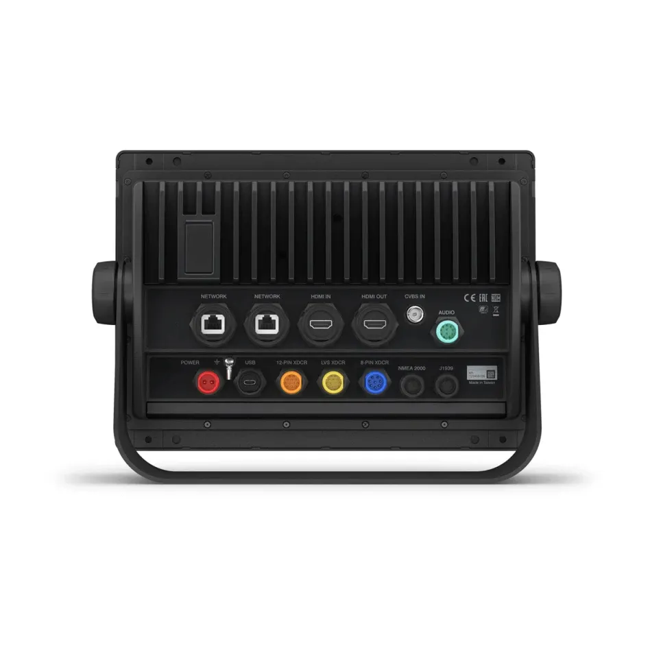
Comprehensive Network Connectivity: Compatible with NMEA 2000® and Garmin Marine Network, allowing integration with radars, autopilots, cameras, and other instruments.
Integrated SailAssist™ Features: Provides data and pre-race guidance to help sailors optimize their performance.
OneHelm™ Compatibility: Enables integrated control of compatible third-party devices directly from the chartplotter screen.
Wireless Connectivity: Incorporates Wi-Fi® and ANT® technology to connect with compatible devices such as quatix® smartwatches and gWind™ Wireless 2 sensors.
Technical Specifications:
Physical Dimensions: 9 inches in height, 14 inches in width, 20 inches in depth.
Weight: Approximately 11.5 pounds.
Display Resolution: 1280 x 800 pixels.
Mounting Options: Edge-to-edge flush mounting for a sleek appearance or standard flush mounting.
Map Compatibility: Supports Garmin Navionics Vision ™ charts for optional premium map content.
The GPSMAP® 8612xsv is the ideal tool for mariners seeking precise navigation and full integration of their marine systems.


